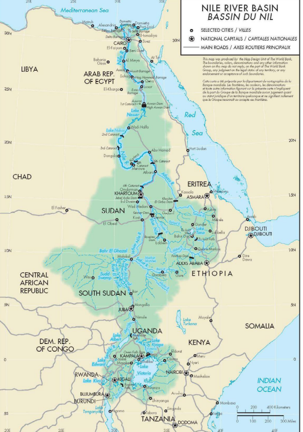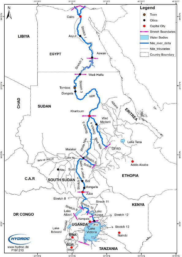
Inland water navigation is an important economic activity for the Nile riparian countries. A number of rivers’ reaches and in-land water bodies in the Nile Basin are navigable. Examples include Lake Victoria, the White Nile between Malakal (South Sudan and Khartoum), Baro Sobat River between Gambella (in Ethiopia) and Malakal (South Sudan), Lake Tana in Ethiopia, to name but a few. It is believed that Navigation will continue to play a key role in interconnecting the Nile Basin countries. Navigation provides opportunities for trade, access to landlocked and improvement in economic cooperation between the countries.
Nile navigation is one of the priority areas for NBI as it addresses one of the fundamental objectives of improvement of cooperation among the Member States as well as providing easy access for the benefit sharing of agricultural products. It is at the same time a water demand on the river that needs consideration alongside irrigation, hydropower and others in the ongoing Strategic Water Resources Analysis being undertaken by NBI.
The Nile Basin 10-year Strategy Goal 3 Strategic Direction 3.5 “is to Enhance navigability to boost regional agricultural trade and transport corridors”. NBI will contribute to studying and preparing projects to improve the navigability of the Nile River system with a view to increasing interconnectivity of the regional transport corridors across the basin. Improved bulk transport options along the Nile corridor will be explored and investments prepared.
The Baseline Situation Assessment of Nile Basin Navigation Report describes the baseline condition of navigational use of the Nile water resources based on available information. It covers the identification of river stretches, lakes, and other water bodies (e.g. wet...
Building a knowledge base on Nile Navigation
The Baseline Situation Assessment of Nile Basin Navigation Report describes the baseline condition of navigational use of the Nile water resources based on available information. It covers the identification of river stretches, lakes, and other water bodies (e.g. wetlands, swamps, waterfalls, cataracts) that are being used for navigation in the River Nile system and list characteristics that are relevant to navigational requirements (including cross-section characteristics, currents, tidal and/or river (velocity, direction, and duration), limitations, etc.). Further, the assessment covers a description of the current river/lake/wetland navigation system. Another key feature of this navigation study is an assessment of the major Nile River ports and their characteristics.
The methodology is based on the implementation of a simple hydraulic model for the derivation of the required relationships. This is because:There is a requirement to have all the information geo-referenced (in a GIS format).The calculation of discharge-stage relatio...
Modelling Approach
The methodology is based on the implementation of a simple hydraulic model for the derivation of the required relationships. This is because:
- There is a requirement to have all the information geo-referenced (in a GIS format).
- The calculation of discharge-stage relationships is very complicated in non-uniform (i.e., rectangular) channels. While in some cases the cross-sections are defined following this shape, a hydraulic model provides a more consistent approach.
- The significant number of cross-sections required are managed better using a hydraulic model.
- The use of a hydraulic model facilitates the testing of different scenarios and different flows.
A steady state HEC-RAS 5.0.7 model has been chosen for the assessment approach.
Nile-SEC presented the Concept Note to the 28th Nile-COM meeting. During this meeting, Nile-COM directed Nile-SEC to respond to any matter of the VICMED project that would impact on the Nile Basin as well as any programme that was undergoing in relation to the develo...
Key Stakeholders Engagement
- Nile-SEC presented the Concept Note to the 28th Nile-COM meeting. During this meeting, Nile-COM directed Nile-SEC to respond to any matter of the VICMED project that would impact on the Nile Basin as well as any programme that was undergoing in relation to the development of the basin. Further, the Nile-TAC, in its 54th meeting, instructed the Nile-SEC that the navigation study “needs to help countries in assessing the options considered under the project on Establishment of a Navigation Route Between Lake Victoria – Mediterranean Sea (VICMED) and their implications.”
- Nile-SEC presented the Nile-NAV study project during the 29th Nile-COM meeting held in Juba, South Sudan on November 26, 2021. Nile-COM took note of the study on “Nile River Navigation Integration of scenarios for sector development into strategic water resources analysis”. The study focuses on impacts on water resources but also includes summary of benefits of enhanced Nile transportation corridor.
- Nile-SEC presented the Nile-NAV study project to the 1st Regional Working Group (REWG) on February 24, 2022 in Dar-es-Salaam, United Republic of Tanzania. This meeting was followed by Stakeholders Navigation ongoing studies in the Nile Basin on February 25, 2022 in the same venue. During these meetings, participants worked in groups and came up with recommendations on the best scenario, which is a minimum development impacts and no regret measures scenario.
- Once the scenarios are fully developed, they will be presented to the 2nd Regional Working Group (REWG) for further refinement before they are shared with the Consultant carrying out the Strategic Water Resources Analysis (SWRA). Thereafter, the study reports will be presented to the Nil-TAC for validation and recommend to the Nile-COM meeting for approval.


